“In every walk with nature, one receives far more than he seeks”- John Muir
When life gets too chaotic, take to the mountains. The mix of exercise-induced endorphins and fresh air quiet the senses. Hiking is like a vitamin. Take hikes regularly, and you’ll be healthier— body, mind, and soul. That may sound a little cheesy, but it’s undeniable. Even a short hike can be a total mood changer. Luckily, in Boulder County, you don’t have to go very far for a beautiful escape. Boulder has some of the most gorgeous trails in the country. And most of them are convenient to the city! It won’t take up your whole day. A quick mountain fix is always available. Our Boulder realtor team here at Burgess Group | Compass has complied a list of the most inspiring (and convenient!) trailheads in Boulder County.

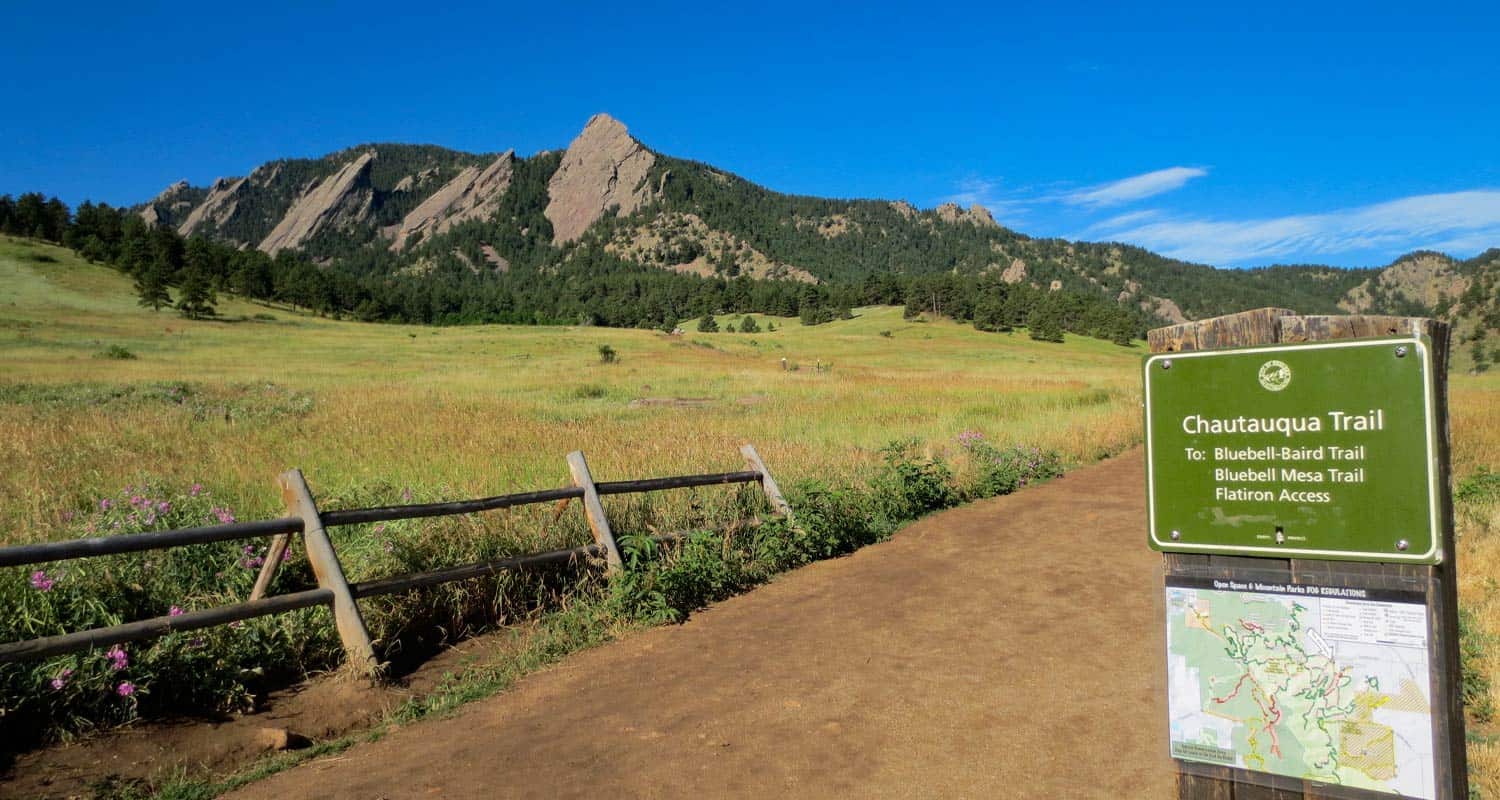
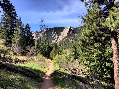
First and Second Flatirons Trail
Distance: 2.7 miles
Route Type: Loop
Elevation: 1,427 ft
Difficulty: Moderate
Dogs Allowed: Yes
The Flatirons are the most iconic feature of Boulder’s landscape. The flat, jagged sandstone peaks are totally unique. There’s nothing else like it in the world. You’ll start the hike in Chautauqua park, and weave your way through meadows and forests before reaching a rock scramble at the top. Once you summit the peaks, try your best to resist pounding your chest and screaming “I’m the king of the world!!” like Tarzan.
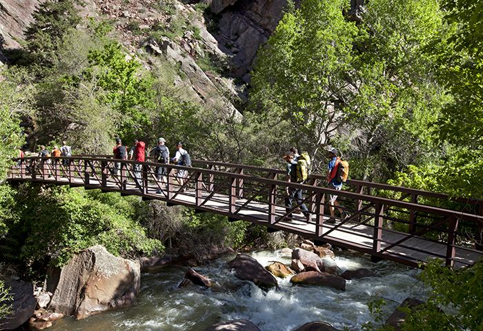
Eldorado Canyon Trail
Distance: 6.6 miles
Route Type: Out & Back
Elevation: 1,994 feet
Difficulty: Moderate
Dogs Allowed: Yes, on leash only
Once you hike into Eldorado Canyon, the world suddenly becomes quiet. The noise of your daily life is replaced by the sounds of a wild creek rushing over rocks. The terrain will take you through pine forests, alongside steep rocky walls, and high vistas. Stop and splash your face when in the cool, crystal clear stream when you start to get tired.
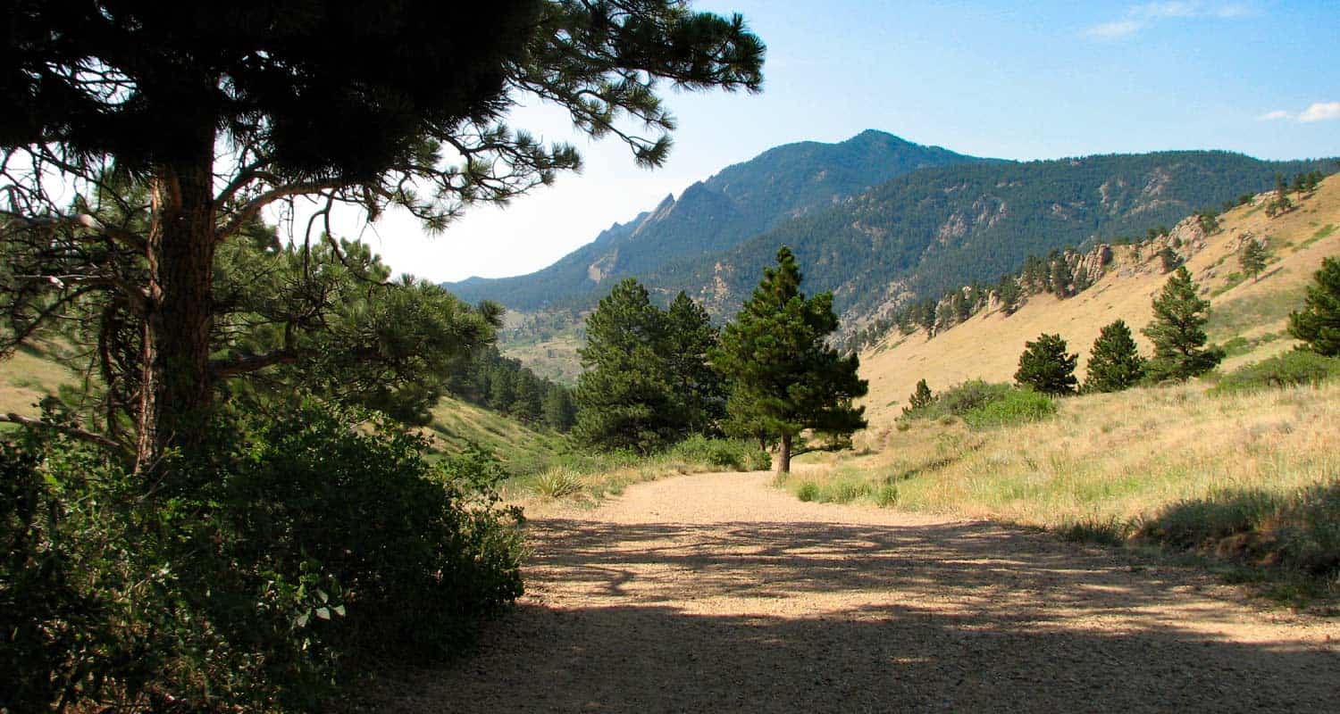
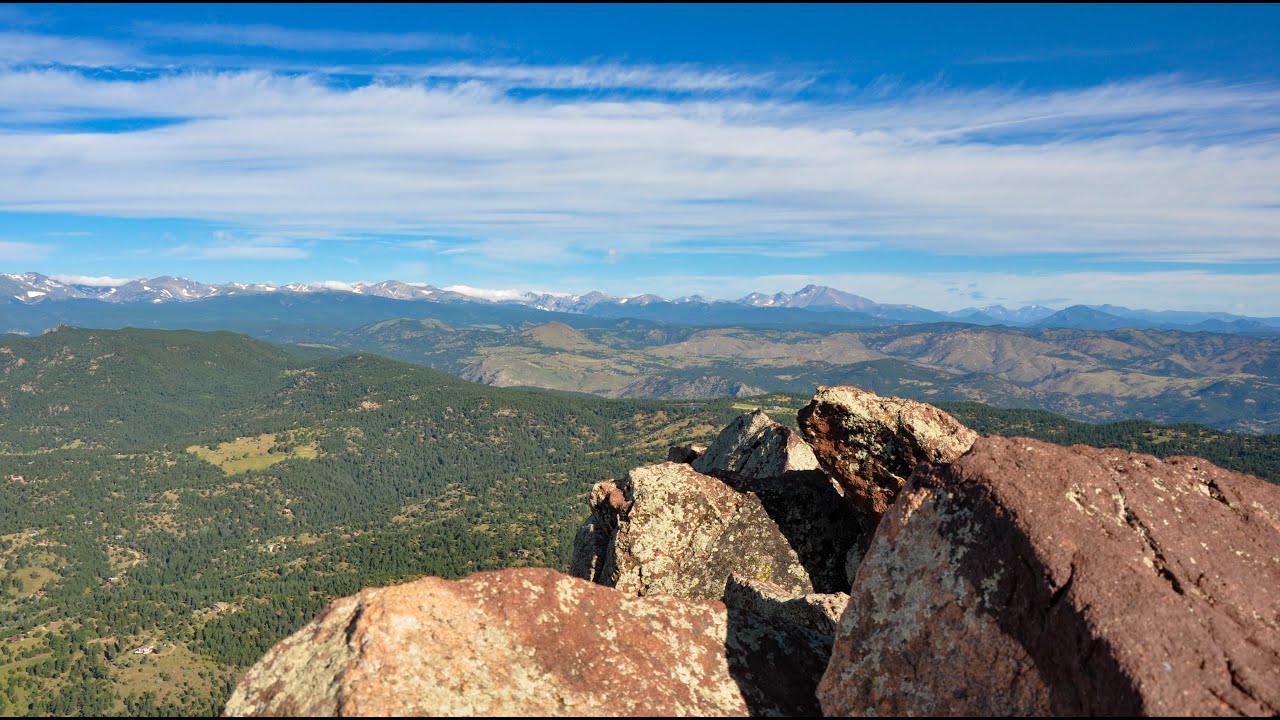
Green Mountain Summit
Distance: 7.3 miles
Route Type: Loop
Elevation: 2,641 ft.
Difficulty: hard
Dogs Allowed: No
You’ll begin this hike in Chautauqua Park, but this route takes you much farther into the wilderness than the flatirons trail. On this trail, you’ll hike out towards the continental divide. Astounding views open out in front of you on both parts of the loop. Steep steps will lead you to the top. Before you go, mentally prepare yourself for a scramble. The rocks and boulders on this trail can feel like an obstacle course. This trail feels very alpine and includes incredible views during the entire route. It’s a strenuous hike, but certainly worth the strain.
Mt. Sanitas and Sanitas Valley Loop Trail
Distance: 3.2 miles
Route Type: Loop
Elevation: 1,256 ft
Difficulty: Hard
Dogs Allowed: Yes, on leash only
This is a summit-style hike, which naturally makes it difficult. But it’s well worth it. Sanitas is widely known as a Boulder bucket-list item, one of our Boulder realtors’ favorites, and it’s relatively short for a summit hike! You won’t have to wait for a “big payoff” at the top. Vista views last the entire trek. At the summit, you will see sweeping views of Boulder and the northwest mountains. It’s a steep, but wonderful journey all the way through.
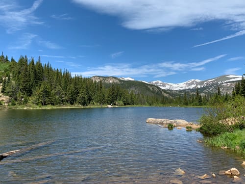
Lost Lakes Trail
Distance: 4 miles
Route Type: Out & Back
Elevation: 830 Feet
Difficulty: Moderate
Dogs Allowed: Yes, on leash only
This trail is unlike any other in Boulder County. A pine and aspen forest leads you to a secluded lake, surrounded by peaks. Along the way, you’ll find wildflowers and a rushing waterfall. This placid alpine lake is perfect for a quick dip to cool off on a hot day. The general opinion of Lost Lake hikers, and our very own Boulder real estate agents, is “well… it doesn’t get much prettier than this!”
South Boulder Peak
Distance: 8 miles
Route Type: Out & Back
Elevation: 2,880 feet
Difficulty: hard
Dogs Allowed: Yes
This trail begins in the foothills and winds you up into the cool, wooded Shadow Canyon. You’ll pass wildflowers, creeks, forests, and interesting burn marks. A short connector trail will bring you to Boulder peak, where you’ll see a unique perspective of the foothills below. Rock formations and spires silhouette your view. You can even spot the Boulder reservoir in the distance!
Enchanted Mesa Trail
Distance: 1.9 miles
Route Type: Loop
Elevation: 419 feet
Difficulty: Easy
Dogs Allowed: No
This loop is a quick and easy nature fix. But the convenience of this trail does not detract from its beauty. This loop includes flatiron vistas and wildflower meadows. The stone bridge over the dappled creek will make you feel like you’re a hobbit gearing up for a big adventure. This trail is aptly named. It certainly feels enchanted.

Flagstaff Mountain Summit
Distance: 5.4 miles
Route Type: Out & Back
Elevation: 1,430 feet
Difficulty: Moderate
Dogs Allowed: No
The Flagstaff summit is the most moderate of the summit trails in Boulder County. You’ll see vivid views of the snow-capped Indian Peaks Wilderness, as well as views of the city below you. On this hike, you’ll explore the gorgeous Gregory canyon which feels secluded and wild.
Dreaming of living next to a trail?
Reach out to the Burgess Group | Compass Boulder realtor team and let us know! Our city is wonderfully integrated into local mountain trail systems. Homes with nearby trail access open up all the time. Join our email list so you can be ready when the perfect home with perfect trail access comes available!
